
What a Taylorsville Block Can Show
A block search should begin with the source, not with a guess about a person. The county map can show adjacent parcel shapes, owner and address fields, property type, imagery, and districts. The Assessor can show the owner, situs, mailing address, parcel ID, value, and classification. Recorder entries can show transfers, liens, plats, and legal descriptions. The city’s community-council page gives civic boundaries and contacts, while historic directories show earlier occupants in selected years.
| Source | What It Shows About a Block | Access |
|---|---|---|
| Assessor Parcel Viewer | Adjacent parcels, owner, address, ID, class, map layers | Free map; 1,000-result limit |
| Assessor block search | Sortable parcel records from the seven-digit prefix | Free classic search |
| Recorder | Deeds, liens, plats, legal descriptions, recorded dates | Free list; paid images or copies |
| Voter records | Public registration fields for non-protected records | Name, DOB, address, and Title 20A rules |
| Community councils | Civic district, leaders, meetings, neighborhood context | City page; no member roster claimed |
| Historic directories | Past street occupants in selected years | Library, Archives, Historical Society |
An owner around the subject parcel is not automatically a current neighbor. The mailing address can be elsewhere. Renters, guests, and other household members may not appear. The table describes a research path, not a promise of a complete block directory.
Select the Parcel, Then Read Outward
The Salt Lake County Assessor Parcel Viewer has Find Parcel Number, Find Owner, and Find Address controls. Once a parcel is selected, click nearby polygons for their property location, owner, and parcel ID. Pan and zoom across the block, or use a distance-in-feet buffer. Draw Line and Polygon tools can mark a street segment. Property Type can narrow a query, and historical imagery labels include 2012, 2013, and 2014.
- Find the starting address in the county parcel viewer.
- Click the starting parcel once to identify its owner, address, and ID.
- Pan and click adjacent polygons, saving each parcel ID.
- Compare each situs address with the owner mailing address in the Assessor.
- Use the Recorder for a dated instrument and the city or Archives for local files.
- For the whole named street, switch to the Taylorsville street directory.
The map supports a close-radius question. It should not be used to settle a boundary or engineering dispute. The county says its data can be incomplete, not current, or a one-time capture, and parcel lines are approximate.
Use the Block-Prefix Search
The Assessor’s parcel instructions offer a practical shortcut. The first seven digits can return a block, with the first four digits representing area or section and the next three identifying block. The result list is sortable. The remaining parcel and encumbrance digits identify the specific property record. Treat the format as the county’s search aid, then verify the parcel page and legal description.
This is an insider advantage for a Taylorsville block search because it can gather neighboring parcels without guessing each street number. It is still a property query. The result does not reveal every person at the property, and a business or trust name may not match a private occupant.
| Parcel layer | Use in a neighbor search |
|---|---|
| First seven digits | Return the county’s block-level parcel group. |
| Parcel ID | Track one mapped property across Assessor, GIS, and Recorder. |
| Situs address | Locate the physical parcel. |
| Mailing address | Show where an owner receives tax correspondence. |
| Legal description | Bridge plats, lots, blocks, subdivisions, and older records. |
Owners Are Not Every Neighbor
The Assessor identifies property records. A situs address identifies the physical place. A mailing address can point to an owner’s correspondence location outside Taylorsville. A primary residential exemption is evidence of a claimed domicile, not proof that the owner is present. It can also apply when a family member occupies the dwelling. A deed chain shows ownership history, not a list of current occupants.
Recorder Data Services can add the recorded instrument, grantor, grantee, date, legal description, mortgage, lien, or plat. The free Public Search requires an address or parcel selected from autocomplete and an agreement to terms. Paid service begins with a $5 small package for 150 units or 24 hours; images are typically available the next working day. Copies can be requested from the Recorder, with $2 per page, historical copies at $5 per page, and certification adding $5 plus $2 per page.
Taylorsville’s Civic Block Layer
Community councils provide a safer way to understand local geography without implying that a private roster exists. Taylorsville’s official inventory runs from 1A and 1B through 5A and 5B. Some councils list leaders and meeting places, while others list no current volunteers and direct questions to city staff. The Public Safety Committee supports Neighborhood Watch and public-safety outreach. The page does not claim a public household or member directory.
| Civic layer | Research detail |
|---|---|
| 1B | Third Thursday at 7 p.m. at the YMCA, 4223 S Atherton. |
| 2A | First Monday at 7 p.m. at City Hall. |
| 2B | Fourth Thursday at 7 p.m. at Majestic Oaks Clubhouse, 4635 S 840 West. |
| 3A | First Tuesday at 7 p.m. in City Council Chambers. |
| Heritage layer | Historic Preservation Committee meets at the Heritage Center, 1488 W 4800 South. |
Meeting details can change, so use the Taylorsville community-council page for current contacts. These groups name civic space, not who lives in a home.
What Public Voter Data Can Say
Utah’s voter data may include legal name, voter ID, age range, residential and mailing address, precinct, districts, party or unaffiliated status, active or inactive status, update date, and vote history. Full date of birth, driver or state ID, and Social Security number are not public. The self-lookup asks for first name, last name, date of birth, street address, city, and ZIP. It is an individual status tool, not a block browse.
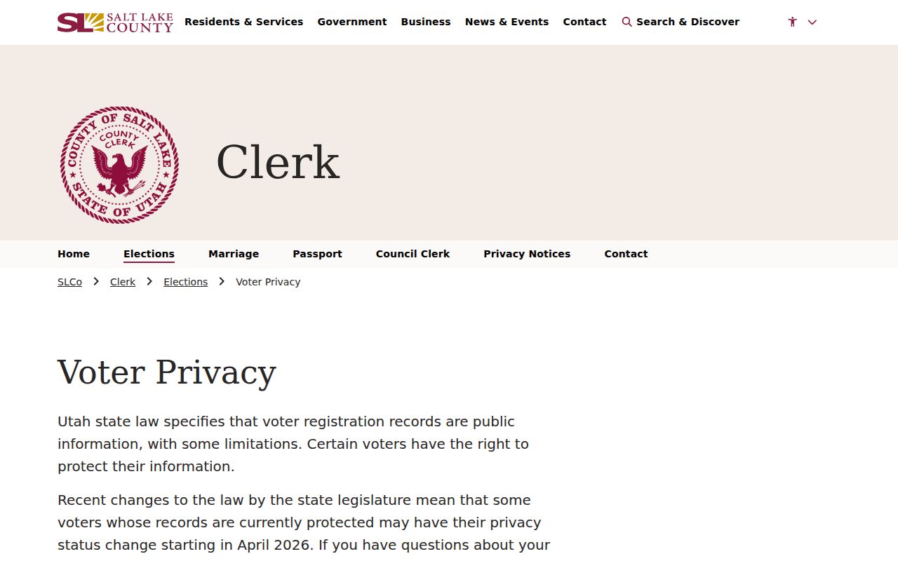
The 2026 SB 153 transition moved Salt Lake County protection to At-Risk status. The county’s page lists May 6, 2026 as the last day to avoid release and May 26, 2026 as public release of non-protected information. At-Risk registrations remain withheld. Title 20A also limits false-pretenses acquisition, unauthorized use, posting, and unlawful disclosure. A block-level file request must go to the County Clerk, and a request does not guarantee release.
The Salt Lake County voter-privacy page explains the protection rules that shape a Taylorsville neighbors lookup.
Local Files Add Block History
City code cases, planning records, building forms, and permits can date a change on a block. Taylorsville’s Building Department says plan review may take up to ten business days, with resubmission restarting that period. Its forms cover permit, owner-builder, contractor, variance, fence, landscaping, and related applications, but they are not a searchable historic index. Use the city records request route for an existing file, with a narrow address and date range.
County Archives can supply permits, appraisal cards, photos, maps, land certificates, tax ledgers, and proof-of-residence material. The house-history collection uses several arrangements, including address, tax serial, original owner and year, and current parcel number. A historic directory can put a person on a street in one year, while a permit can show work at the structure in another.
ZIPs and Service Areas Cross Edges
Taylorsville uses 84118, 84123, and 84129 in official and institutional material. Nearby 84119 and 84115 appear in border or service contexts. ZIPs are delivery constructs, not city limits. Taylorsville-Bennion Improvement District serves most of Taylorsville, while Granger-Hunter and Kearns Improvement Districts serve border areas. The utility geography can clarify an edge, but customer names and consumption records are not a neighbor list.
Use USPS for the exact ZIP, the Assessor for the parcel, and the city or county source for jurisdiction. Utah’s ZIP polygons are approximate; the November 2025 west-side update improved alignment with address points but did not change municipal lines.
Privacy Limits on a Neighbor Lookup
Safe at Home protects the actual home address, city or county, precinct, phone, and related identifying details for qualifying survivors who use a substitute address. DMV records are protected under federal and Utah rules. Utility customer data is not a public household index. A commercial data tool may merge names, repeat old material, or omit protected people, so it is not a substitute for a custodian’s record.
Lawful use. Use neighbor records for ordinary civic knowledge, family history, reconnecting, and personal safety awareness. Do not use a Taylorsville address to watch, threaten, stalk, harass, or harm another person.
If a record appears wrong, contact its custodian. The Assessor handles parcels, the Recorder handles instruments, Elections handles voter data, and Taylorsville handles its own city files. Utah’s anti-stalking statute, Section 76-5-106.5, includes monitoring, surveillance, approaching a residence, and contacting a neighbor to obtain or spread information among the conduct that can matter in a course of conduct.
From One Address to a Wider Street
A block question and a whole-street question need different tools. The map and block-prefix search are useful for nearby parcels. The Recorder and city files add dated property events. Historic directories add selected occupants. When the research needs every parcel along a named road, use the address-first street workflow and preserve the exact address, ZIP, parcel, and legal description at each step.
The strongest neighbor result is modest: it says what a public parcel, civic, voter, or historic record shows, when it was created, and which gaps remain. That makes the search useful without pretending that public records reveal every household.